As arranged, everybody met (well nearly everybody) at the Village Hall car park at nine am. Sixteen plus two walkers to follow - what a great turnout.
It was a dry morning with the promise of some sunshine at about eleven am.
We sorted ourselves into cars, armed with maps, tom toms and packed lunches calling in on our remaining two walkers on the way out of Cosby.
Driving up to Millers Dale should, at a nice steady pace, take just under 2 hours.
 |
| Millers Dale Railway Station |
After the journey up to
Miller’s Dale, we ‘got booted up’ and with
lunch bags slung over our
shoulders set off at approx 11am.
.
 |
| Boot camp |
 |
| That is confusing |
 |
Our walking route directions with photos along the way were as follows:
 |
| Under the bridge again |
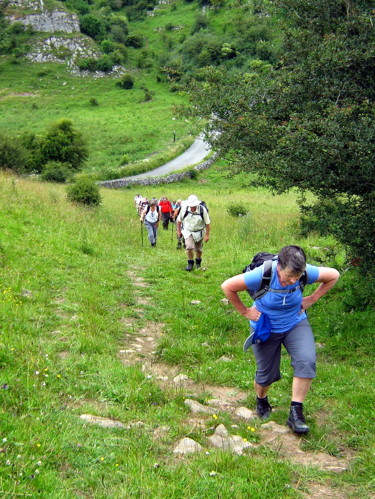
Leave the car park via the main entrance and turn right down the road and under the bridge. At the junction
with the B6049 turn left to walk through the village passing under the bridge
again. In about 500 metres bear off right to follow the pretty minor road to
“Litton Mill Only”. Pass the Anglers Rest and continue along the single-track
road for about a mile. |
 |
Under the bridge out of the car park
|
 |
| The Anglers Rest |
 |
| Fish spotting |
 |
| Happy walkers |
From this bridge and for quite a long way down the river path you could spot trout quite easily.
Just before the “No public
parking at Litton Mill” sign and by a lay-by, turn left signed “Tideswell Dale”. Walk up the interesting gently sloping dale for about a mile. You will go
through one gate and at the second bridge you can turn right or go straight on
as the two branches of the brook-side path meet up ahead.
 |
| The weather is spot on |
 |
| Wild geraniums |
 |
| They grow their wildlife big up here |
 |
| Plenty of information along the route |


Tree carving at the front and fungi at the back.
Walk through the car park and picnic area. Near the road entrance on the left keep
straight on along a tree-lined path. At the end of the path go through a small
gate. Follow the road and wall on left. When you reach a fence ahead go through
a small gate on the left to cross the road. Walk up into Tideswell.
 |
| Leaving the car park |
 |
| Route up to Tideswell |
 |
| Funny place to park |
 |
| Entering the village of Tideswell |
In just over a ¼ of a mile and
at the start of the village, pass Richard Lane on the left. Turn up steps by
the bus shelter. At the road turn right. Follow the narrow road parallel to the
main road (Thorncliffe Terrace). At “The Horse and Jockey” I suggest this looks
like a good place for lunch - seats available outside the pub (public and pub
seats) toilets obviously in pub and public toilets 100 yds up the street. We would
have walked about 3 miles at this point and I estimate the time to be around 1
o’clock.
Climbing to Thorncliffe Terrace
 |
| Ready for the walk down to The Horse and Jockey |
 Nearly there
 .
 |
| The Horse and Jockey |
 |
| A welcome break for lunch |
After lunch, just before “The
Horse and Jockey” there is Primrose Lane. Go up here - it is steep and narrow.
Cross the road diagonally right
to go through a stile by a farm gate.
Walk over three fields crossing
three stiles and keeping a wall close on the right.
Cross a track diagonally to go
over the stile. Keep straight on still with the wall on the right. Cross four
fields and stiles.
 |
| Up the steep path |
 |
| Be careful on the stiles around here |
 |
| Looking back at Tideswell |
 |
| These stiles don't get any easier |
In the fifth field bear left over a stile then continue ahead crossing three more fields and stiles (the third field is almost a track). Keep straight down the middle of the field aiming for a wall corner and passing a dew pond on the left. Cross the wall stile ahead and keep straight on up the field with the wall on the left. Cross a stile in the field corner.
 |
| Not bad this one |
 |
| And you have to queue |
Turn right along the track. At the cross roads - long route straight on, short route turn left. ????
 |
| Wobbly stone |
 |
| Cows up ahead |
 |
| Be quiet and they won't know we are here. |

There is more to walking in the dales, than spectacular scenery - some of it is a bit of a challenge!
 |
| A decision has to be made now short route or long route.? |
By democratic vote the decision was to take the short route.
Follow
the descending minor road for just over ½ mile. At
the bottom of the hill, where the paths cross the road turn left signed Millers
Dale.
Climb
the steep hillside aiming for, and then following, an old wall, hawthorns and a
fence on the left. Go through a gate or stile. Follow a walled path gradually
uphill. When you meet a wall ahead turn right to continue uphill on a grass
path, in about 175 mtrs cross a stile by a gate and immediately turn left over
another stile. Follow the wall on the left. Shortly you will enter a walled
track.
 |
| Off We Go |


Nearly there !!!!!!!!!

 |
| We all had a rest and took some photos |
At the end of this track keep
on across the field and through a kissing gate. Carry on across the middle of
the field aiming for the farm and farm gate. Turn left by the farm gate to
cross the stile. Follow the short winding path
round a right hand bend to the church drive. Notice the Helm Tower. Turn
right to follow the church road to the T junction of the roads in Wormhill.
 |
Group Photo at the entrance to Worm Hill
Turn left along the road and in about 400 mtrs at the decontrolled sign leave the road to walk down a track on the right. Pass a cottage on the left then go through a gate to walk down the woodland path and through another gate. As you leave the wood keep straight on along the higher grass path. |
 |
| Walking through Worm Hill |
 |
| Something interesting. |
 |
| Somebody thought it was funny. |
Soon
you will bend round to the left before gradually descending the valley side.
The lower limestone rocky slopes can be quite slippy after heavy rain. In the
valley bottom go through a small gate and turn left to follow the river Wye on
your right.


Country side pictures
 |
| The river Wye |

 |
| Walking along the banks |

Just before the viaduct turn
sharp left up the steep stone steps to the Monsal Trail. At this point you
should continue along the riverside path to the road then turn left back up to
the car park. Turn left along the trail passing the impressive lime kilns. In
about ½ mile you will be back at the car park.

 |
| Making our way back up on to the Monsal Trail |
 |
| Nearly there now |
 |
| No train coming |
 |
| Boots off |
 |
Map of the walk
We all agreed dinner was very good value and quality.
|
Think we might come back next year.
If anybody wants to use the directions of the walk please do - it is a fantastic walk
Just received some more pictures from one of the walkers.


No comments:
Post a Comment