The sun was up early to greet us for our drive to Derbyshire from Cosby. We set off at about 9.00am for Bakewell/Miller's Dale.
A brief description of where we were headed for:
The Monsal Trail is a traffic free route for walkers, cyclists, horse riders and wheelchair users through some of the Peak District's most spectacular limestone dales.
The trail runs along the former Midland Railway line for 8.5 miles between Blackwell Mill, in Chee Dale and Coombs Road, at Bakewell.
Most of the route was opened to the public in 1981 but four former railway tunnels had to remain closed due to safety reasons, with public footpaths taking people around them. From 25 May 2011 the four railway tunnels - Headstone Tunnel, Cressbrook Tunnel, Litton Tunnel, Chee Tor Tunnel – will also open for trail users. Each tunnel is about 400 metres long and will be lit during normal daylight hours.
Two shorter tunnels - Chee Tor No.2 and Rusher Cutting – already formed part of the Monsal Trail.
The public can now experience the full length of the former railway route at their own pace and see breathtaking views at places like Water-cum-Jolly Dale that have remained hidden since the railway closed in 1968.
For info: Millers Dale served an important junction where passengers for Buxton joined or left the trains between London and Manchester. It was originally to be called "Blackwell Mill" but, in the end, was named "Millers Dale for Tideswell". For such a rural location, it was unusually large; indeed, it was one of the largest stations on the line, and was one of the few stations in England to have a post office on the platform. Millers Dale also sent dairy, agricultural and quarried products from the surrounding areas to the major cities. While also serving local towns and villages—notably Tideswell, Taddington and Wormhill—much of its activity was concerned with the connecting service to and from Buxton. Traffic for Buxton actually followed the main line north for nearly two miles, before diverging at Millers Dale Junction, beside Blackwell Mill Halt.
It served an important junction where passengers for Buxton joined or left the trains between London and Manchester. It was originally to be called "Blackwell Mill" but, in the end, was named "Millers Dale for Tideswell". For such a rural location, it was unusually large; indeed, it was one of the largest stations on the line, and was one of the few stations in England to have a post office on the platform. Millers Dale also sent dairy, agricultural and quarried products from the surrounding areas to the major cities. While also serving local towns and villages—notably Tideswell, Taddington and Wormhill—much of its activity was concerned with the connecting service to and from Buxton. Traffic for Buxton actually followed the main line north for nearly two miles, before diverging at Millers Dale Junction, beside Blackwell Mill Halt.
The sun was shining as we set off on our walk.
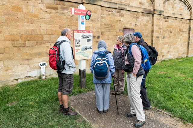
Just checking that we were going in the right direction.
These bridges span across the road up to Worm Hill and then the B6049 to Tideswell. As you can see from the height of the bridges above the road, quiet an engineering feat.

The spectacular views appeared around every bend - imagine what a trip this would have been on a steam train.
Approaching Litton Mill.
This pictures shows volcanic rock from ages past.
Looking over to Litton Mill. (Luxury apartments nowadays)
For info: The original 19th-century mill became notorious during the Industrial Revolution for its unsavoury employment practices, luridly described by the commentators of the day, and the testimony of Robert Blincoe, a parish apprentice who had been indentured to work at the mill.
It was set up in 1782 by Ellis Needham and Thomas Frith, both farmers with small estates in the area. The mill was powered by the water of the River Wye, using Richard Arkwright's water frame. It could be said that the company was doomed from the start. Needham, in particular, had sunk most of his assets into the venture. The valley was particularly isolated and transport for the raw material and finished goods was poor. Moreover, they had difficulty in attracting a workforce.
The early spinners, such as Arkwright and Strutt, had been able to attract the families of weavers and framework knitters, so-called "free labour" meaning the employees were not indentured. Meanwhile, Evans at Darley Abbeycould draw on a pool of labour from the town of Derby. In contrast, the area around Litton was sparsely populated by farming people who were scornful of the new cotton industry.
By 1786 the, barely profitable, mill was put up for sale. There were no buyers and Needham and Frith struggled on. Needham's money had gone and he was farming on rented land, while Frith left the partnership in 1799.
Leaving the mill behind we headed off to our first tunnel on the walk, Litton Tunnel. We had brought torches with us just in case somebody decided to switch the lights off.
Lights were on, no problems.
A little bit of information for railway enthusiasts.
Litton Tunnel, structure number 69, follows a curved alignment, extending for 515 yards. Neither approach cutting is long thanks to the steeply rising hillside on its south side. At the east end, the cutting features impressive vertical rock faces.
Westbound trains encountered a very short straight section before a long southerly curve of 40 chains radius. The gradient throughout rises at 1:100. The predominant lining material is engineering brick although patch repairs - some of them extensive - have been carried out in both red brick and masonry. The tunnel's segmental roof arch is supported on limestone walls which lean outwards at the top. At the west end, a change in section sees much higher side walls and an arch with a very shallow rise.
These three walkers really are happy, just the camera caught them all at a bad time. Honest!
The view coming out of the tunnel.
Overlooking the views between the Litton Tunnel and the Cresswell Tunnel.
Overlooking Cressbrook Hall we headed into Cressbrook Tunnel, an area of special interest to a couple of our walkers who lived around here as children.
Info on Cressbrook Mill and Village.
Cressbrook is a village in the Peak District National Park in Derbyshire. Population details at the 2011 Census are included in the civil parish of Litton. Before its Enclosure Act of 1762 Cressbrook did not exist. It later grew up around a textile mill complex built alongside the River Wye, first by Richard Arkwright and then later by his son Richard, JL Philips and Brother Cotton Spinners and McConnel and Company.
Until McConnel's period of ownership the village did not exist beyond a collection of buildings in the immediate vicinity of the mill. When McConnel's workforce objected to the quality of the housing available he took it upon himself to build the model village that became Cressbrook. Building started in the late 1830s and was later extended by Henry McConnel's daughter, Mary Worthington, in 1902 to include a village club, modelled on a working men's club. Cressbrook Mill went bankrupt in 1965, after which time it changed from being a private mill estate to the public village that it now is.
No torches needed again.
Willie, Sheila and Naire thought it would be a good idea if they had their photos taken at this point.
Got to make sure that everybody is sitting comfortably.
From here we started on our short walk to Monsal Head where we would have our lunch.

As we all grouped together somebody remarked that there were no seats.
Well there are, but they are up there.
It was a short, steep climb but well worth it for the views and the seats.
Views to wow us.
Lunch time, great views and good food.
A little bit of info:
Monsal Head is a famous beauty spot with a magnificent view down Monsal Dale and up the Wye valley. The position is at a spot where the Wye, on its passage eastwards to meet the Derwent, encounters a band of harder rock and is forced to make a sharp turn southwards and carve its way through a high ridge of limestone. The view is spectacular, with the river far below, winding through a steep-sided and often rocky valley.
Puddings from the local ice cream man.
Everybody thoroughly enjoying a little bit of feet up time.
More views for our threesome to take in.
Looking for leftovers.
This is why the local ice cream was so good - its BRADWELL'S the PEAK of EXCELLENCE!
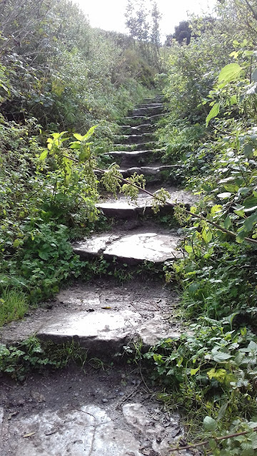
After a well earned rest we started on our descent back to the trail taking care as going down on the slippery steps is just as difficult as going up.
Steep sides to cliffs and a threat of the odd boulder joining you at the bottom.
Trying to get that elusive winning photo.
Very good everybody looking the same way.
Horses were here earlier - there are tell tale signs.
At the old Hassop Station for coffee and feet up before the last two miles to Bakewell.
Someone with a sense of humour we think!
As we walked from Hassop Station to Bakewell it started to rain a little.
This guy has already got his coat on.
Dressed for the occasion.
Arriving at Bakewell Station. Got to say this to the people of Bakewell 'what a fantastic walk to have on your doorstep'.
The all important refreshment information.
The old station at Bakewell. We left the Monsal Trail here and headed into Bakewell itself.
The bridge into Bakewell is locked with thousands of locks by couples showing their affection for each other.
A pot of gold at the end of a rainbow.
In Bakewell, groups of us went our separate ways, most of us having a coffee or tea before taking a leisurely look around the town, some unable to resist the famous Bakewell Pudding.
A short while later we all met up again at Rowsley for an evening meal at the Grouse and Claret where we drank a toast to absent friends, one of whom inspired this lovely walk for us to enjoy - thank you so much.


